Flathead Lake
Bigfork
Montana's Village by the Bay where art meets lakefront luxury
About Bigfork
Montana's Village by the Bay where art meets lakefront luxury
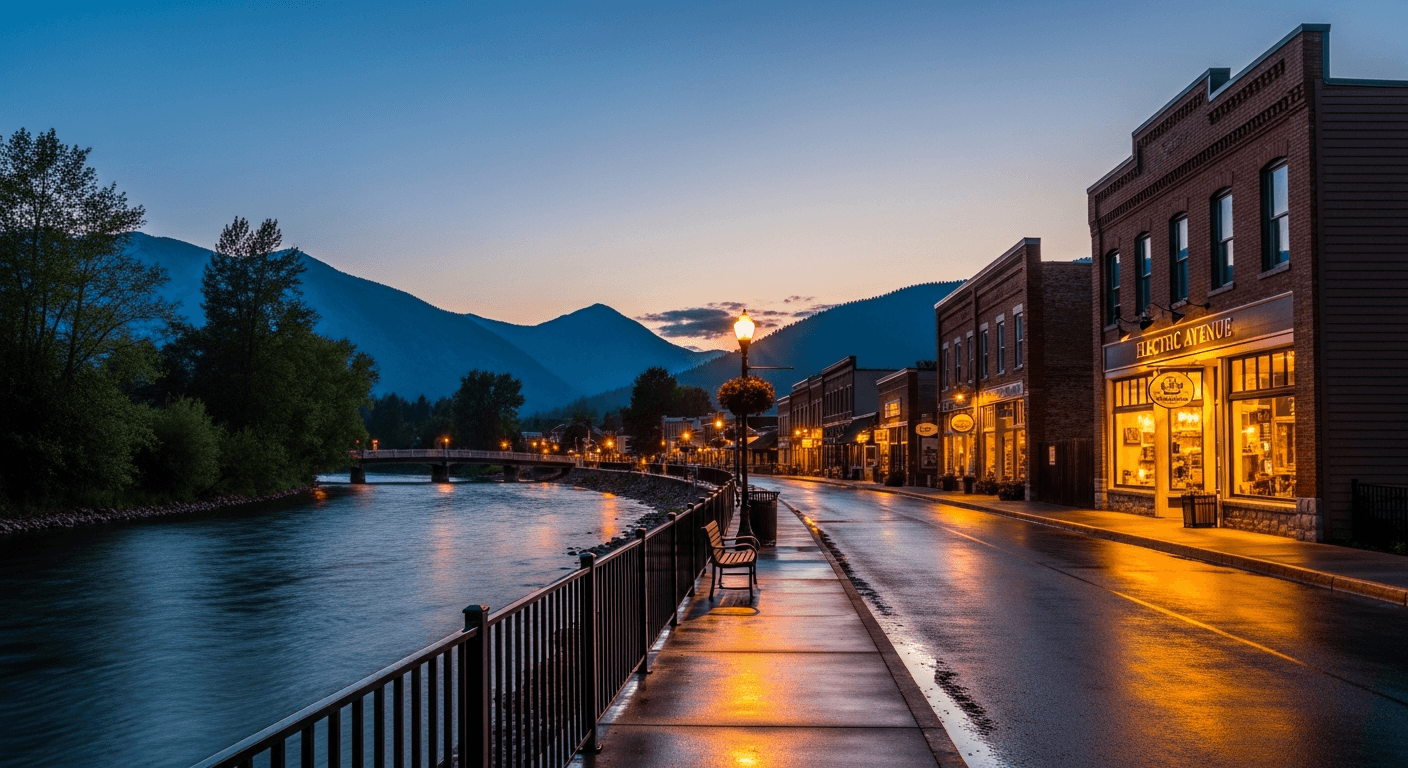
Tucked into the northeast corner of Flathead Lake at the mouth of the Swan River, Bigfork is Montana's most beloved arts village and the largest town on the largest natural freshwater lake west of the Mississippi. Known as the 'Village by the Bay,' this walkable village of roughly 5,000 residents at the 2020 census has earned a reputation as one of the best small towns in the American West, anchored by the Bigfork Summer Playhouse, a Montana Governor's Award recipient recruiting Broadway-caliber talent, and a year-round Electric Avenue lined with galleries, fine boutiques, and farm-to-table restaurants. Summers bring the first weekend of August's Bigfork Festival of the Arts, Rumble in the Bay events, and Wild Mile whitewater on the Swan River.
The location is the luxury draw: 45 minutes to Glacier National Park's west entrance, 33 miles to Whitefish Mountain Resort, and 18 miles to Kalispell's Glacier Park International Airport. The pace remains decidedly village. Buyers here are typically second-home owners, retirees, and remote-work professionals seeking lakefront estates in gated enclaves like Eagle Bend, Harbor Village, and Lake Pointe, or multi-generational ranches tucked into the Swan and Flathead valleys. As of 2026, with Jewel Basin's 15,000 acres of Flathead National Forest trails, a 27-hole championship golf course, and deep-water Flathead Lake frontage, Bigfork offers a luxury portfolio that rivals Whitefish at comparatively quieter price points.
Market Snapshot
What is the Bigfork real estate market like?
Market has cooled from 2024 peak with longer DOM and softer pricing, creating a rare buyer-favorable window in a historically supply-constrained luxury lake market.
| Measure | Bigfork reading | What it tells a buyer |
|---|---|---|
| Median Price | $1.1M (2026 estimate) | The midpoint of recent activity, not a valuation of any one home. |
| Price Range | $525k – $8.5M+ | How far the market stretches from entry stock to the top of the market. |
| Price / Sq Ft | $448 | Useful for comparing similar homes; misleading across different lot sizes. |
| Days on Market | 92 | Longer figures generally mean more room to negotiate. |
| YoY Change | -3% | Direction of travel over the past year, not a forecast. |
| Property Types | Lakefront estates, golf course homes, waterfront condos, custom mountain homes, riverfront ranches, in-town cottages | What is actually available here, which shapes what a budget reaches. |
Sources: MT Lux Real Estate working estimates for 2026, read from active and closed regional listing activity. These are our own observations, not a published index, and they describe the area rather than any one property. Confirm current figures for a specific address before relying on them.
Lifestyle
What is it like to live in Bigfork?
Bigfork attracts affluent second-home buyers from California, Texas, and the Pacific Northwest, along with retirees relocating from higher-tax states, Glacier-adjacent vacation investors, and remote-work professionals trading urban density for lake-and-mountain lifestyle.
- Dining
- Electric Avenue anchors the scene with Showthyme Act II's New American tasting menus, the historic Bigfork Inn (circa 1937), The Eatery at Bigfork, and La Provence for European fare.
- Outdoors
- Jewel Basin Hiking Area offers 35 miles of trails across 15,000 acres and 27 alpine lakes, while the Wild Mile of the Swan River draws whitewater paddlers and Flathead Lake provides world-class sailing, boating, and cherry-orchard shoreline access.
- Culture
- Home to the Bigfork Summer Playhouse (Theatre by the Bay), the Bigfork Center for the Performing Arts, the Bigfork Art and Cultural Center, and the renowned Bigfork Festival of the Arts held the first weekend of August.
- Schools
- Served by Bigfork School District 38, a consistently top-rated K-12 district of roughly 880 students with dual-enrollment partnerships through Flathead Valley Community College.
- Shopping
- Electric Avenue's walkable village features galleries like Bjorge's and Buffalo Trails, Kathy McDonnell Jewelry, S.M. Bradford Co., and MyRealMontana, plus full retail access in Kalispell just 18 miles west.
Housing
What does your budget buy in Bigfork?
Housing in Bigfork runs to lakefront estates, golf course homes, waterfront condos, custom mountain homes, riverfront ranches, in-town cottages. The two tiers below describe what each budget reaches today, and the gap between them is usually land, frontage or access rather than square footage.
Entry Tier
At 2026 prices, $600k–$1M buys a 3-bedroom village cottage, a Swan Valley log cabin on acreage, or a townhome at Eagle Bend with golf course access and shared marina amenities.
Luxury Tier
At 2026 prices, $2.5M+ reaches Flathead Lake frontage with private dock, Lake Pointe or Harbor Village gated estates, or custom architect-designed homes at Woods Bay Point with peninsula views and five-bedroom layouts.
Check any Bigfork address against the record. Parcel lines, ownership and acreage are on the Montana Cadastral property map. Water rights, which transfer separately from the land, are searchable through the Montana DNRC water rights records. Assessed values and current tax treatment are on Property.MT.gov. A map or an assessment record screens a question. It does not replace a survey, a title opinion or an inspection.
Comparing towns? Ashley works the whole corridor: browse every Western Montana community, or read the 2026 Western Montana market report for how these submarkets moved against each other.
Ready to Explore Bigfork?
Let’s talk through the Bigfork market.
Tell us what you’re looking for — whether buying, selling, or simply exploring — and we’ll return with a curated strategy.
Request a Bigfork property shortlistCommon Questions
Common questions about Bigfork
- Why Bigfork?
- Bigfork combines a genuine walkable arts village (live theater, galleries, and farm-to-table dining on Electric Avenue) with deep-water Flathead Lake frontage, Jewel Basin wilderness access, and a 45-minute drive to Glacier National Park. It offers the luxury lake lifestyle of Whitefish at slightly quieter, less discovered price points.
- What's the commute to Kalispell or Whitefish?
- Kalispell sits 18 miles west (roughly 25 minutes) and hosts Glacier Park International Airport plus full retail and medical services. Whitefish is 33 miles north (about 45 minutes), giving Bigfork owners easy access to Whitefish Mountain Resort skiing and the broader resort economy without the in-town crowds.
- Are lakefront homes available on Flathead Lake?
- Yes. Bigfork has the largest concentration of Flathead Lake luxury inventory, from gated enclaves like Harbor Village and Lake Pointe to custom peninsula estates at Woods Bay Point and the Eagle Bend community along the North Shore. True lakefront with private dock typically starts in the $2.5M range and scales well past $8M for legacy compounds.
- What's the arts scene like?
- Exceptional for a village this size. The Bigfork Summer Playhouse has been producing professional Broadway-caliber theatre since 1960 and holds a Montana Governor's Award for the Arts. Add the Bigfork Center for the Performing Arts, the Art and Cultural Center, dozens of galleries, and the August Festival of the Arts, and Bigfork punches far above its weight culturally.
- What are property taxes like?
- Flathead County's median effective property tax rate is approximately 0.57% of assessed value, among the lower rates in the West. Montana has no state sales tax, and the 2026 property tax structure distinguishes primary residences from second homes and short-term rentals, so tax planning matters for vacation-home buyers.
- Is Bigfork good for families or retirees?
- Both. Bigfork School District 38 is highly regarded with dual-enrollment options through Flathead Valley Community College, and the village's walkability, safety, and recreation access suit families. For retirees, the combination of arts, golf at Eagle Bend's 27-hole championship course, lake amenities, and low tax burden has made Bigfork a premier Montana retirement destination.
- What should I check before buying Flathead Lake frontage in Bigfork?
- Three things that are separate from the deed, and each one has sunk a closing. First, whether the dock is permitted: a dock already in the water is not proof it was approved, and shoreline work on Flathead Lake falls under Montana's Lakeshore Protection Act administered through Flathead County. Second, what the frontage actually conveys, because some parcels carry shared or deeded access rather than private frontage, and the listing photo will not tell you which. Third, any water right attached to the property, which transfers separately from the land and should be confirmed against Montana DNRC records rather than assumed.
Stay in Touch
Let’s make your next move in Bigfork.
Send a note below or call directly. We respond to every inquiry personally.