Glacier Country
Columbia Falls
Montana's authentic gateway to Glacier National Park
About Columbia Falls
Montana's authentic gateway to Glacier National Park
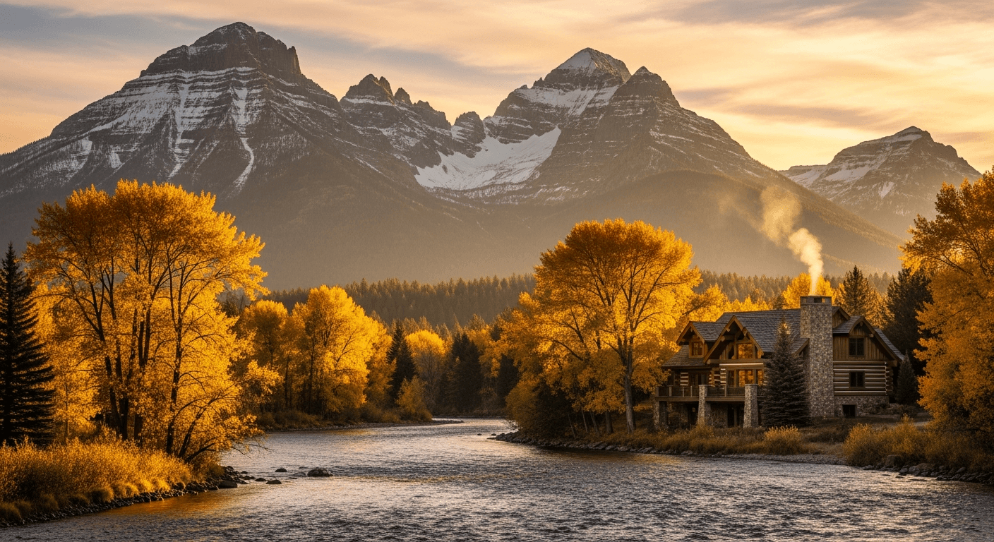
Columbia Falls sits at the junction of US-2 and MT-40 just 15 miles west of Glacier National Park's west entrance, making it the closest full-service town to the park and a year-round magnet for adventure-driven buyers. The Flathead River carves through the edge of town, and Bad Rock Canyon, the Hungry Horse Reservoir, and the Whitefish Range are all within minutes. With roughly 5,300 residents at the 2020 census, the town has traded its timber-mill past for a walkable downtown of independent shops, breweries, and restaurants like the Nite Owl and Back Room.
The real estate story here is defined by proximity and scarcity: Meadow Lake Resort anchors the luxury end with golf-course estates, villas, and condominiums, while riverfront acreage along the Flathead commands premium pricing. Columbia Falls has become the value alternative to Whitefish and Bigfork for buyers who want Glacier access without resort-town price tags, though the 2026 luxury segment continues to climb as the broader Flathead Valley splits into a two-tier market. Glacier Park International Airport is a 15-minute drive, Whitefish Mountain Resort is 25 minutes, and Kalispell's hospitals and retail sit 20 minutes south.
Market Snapshot
What is the Columbia Falls real estate market like?
Lower tier softening while luxury and riverfront continue to appreciate in a more balanced 2026 market.
| Measure | Columbia Falls reading | What it tells a buyer |
|---|---|---|
| Median Price | $615k (2026 estimate) | The midpoint of recent activity, not a valuation of any one home. |
| Price Range | $450k – $4.5M | How far the market stretches from entry stock to the top of the market. |
| Price / Sq Ft | $335 | Useful for comparing similar homes; misleading across different lot sizes. |
| Days on Market | 85 | Longer figures generally mean more room to negotiate. |
| YoY Change | +2.6% | Direction of travel over the past year, not a forecast. |
| Property Types | Single-family homes, Meadow Lake golf villas, riverfront estates, condos, townhomes, acreage | What is actually available here, which shapes what a budget reaches. |
Sources: MT Lux Real Estate working estimates for 2026, read from active and closed regional listing activity. These are our own observations, not a published index, and they describe the area rather than any one property. Confirm current figures for a specific address before relying on them.
Lifestyle
What is it like to live in Columbia Falls?
Primary buyers are second-home owners seeking a Glacier National Park base camp, Pacific Northwest and California relocators trading coastal prices for Montana lifestyle, and active retirees drawn to Meadow Lake's amenities.
- Dining
- Walkable Nucleus Avenue district with the Nite Owl and Back Room, Three Forks Grille, Montana Coffee Traders, and Backslope Brewing anchoring a growing independent food scene.
- Outdoors
- 15 minutes to Glacier National Park's west entrance, whitewater and fly fishing on all three forks of the Flathead River, and hiking, ice climbing, and wildlife viewing in Bad Rock Canyon.
- Culture
- Heritage Days festival, the Columbia Falls Community Market, and Montana Vortex keep a small-town cultural pulse alive year-round.
- Schools
- Served by School District 6, including Glacier Gateway and Ruder Elementary, Columbia Falls Junior High, and Columbia Falls High School (Wildcats).
- Shopping
- Local boutiques and outfitters along Nucleus Avenue, with Kalispell's big-box retail and Whitefish's luxury shopping each under 20 minutes away.
Housing
What does your budget buy in Columbia Falls?
Housing in Columbia Falls runs to single-family homes, Meadow Lake golf villas, riverfront estates, condos, townhomes, acreage. The two tiers below describe what each budget reaches today, and the gap between them is usually land, frontage or access rather than square footage.
Entry Tier
In 2026, in the $400k–$700k range, buyers find 3-bed single-family homes on in-town lots, newer subdivision builds, and Meadow Lake condos and townhomes with resort amenities included.
Luxury Tier
At 2026 prices, at $1.5M and above, the market opens up to Flathead riverfront acreage, custom log and timber-frame homes, Meadow Lake golf-course estates, and rare mountain-view parcels trending toward $4M+ for prime frontage.
Check any Columbia Falls address against the record. Parcel lines, ownership and acreage are on the Montana Cadastral property map. Water rights, which transfer separately from the land, are searchable through the Montana DNRC water rights records. Assessed values and current tax treatment are on Property.MT.gov. A map or an assessment record screens a question. It does not replace a survey, a title opinion or an inspection.
Comparing towns? Ashley works the whole corridor: browse every Western Montana community, or read the 2026 Western Montana market report for how these submarkets moved against each other.
Ready to Explore Columbia Falls?
Let’s talk through the Columbia Falls market.
Tell us what you’re looking for — whether buying, selling, or simply exploring — and we’ll return with a curated strategy.
Request a Columbia Falls property shortlistCommon Questions
Common questions about Columbia Falls
- Why Columbia Falls?
- It's the closest full-service town to Glacier National Park's west entrance, offers meaningfully better value than Whitefish or Bigfork, and delivers an authentic downtown plus luxury inventory at Meadow Lake Resort and along the Flathead River.
- How close to Glacier National Park?
- About 15 miles (roughly 15 minutes) to the west entrance at West Glacier, making Columbia Falls the most convenient year-round base for the park.
- Commute to Kalispell or Whitefish?
- Kalispell is 16 miles (about 20 minutes) south on US-2, and Whitefish is 10 miles (about 17 minutes) northwest via MT-40. Both are easily accessible for work, shopping, or dining.
- Are vacation rentals allowed?
- Yes, but regulated. Inside city limits, short-term rentals are permitted by right in commercial zones and require an Administrative Conditional Use Permit in residential zones, plus a Montana Public Accommodation (Tourist Home) license. Flathead County has adopted additional rules for unincorporated areas near the park, including 24-hour contact requirements and occupancy limits.
- What are property taxes like?
- Flathead County's effective property tax rate runs around 0.57%, well below the national median of 1.02%, though the exact bill varies by school, fire, and special-district levies within Columbia Falls.
- What's winter like?
- Expect a true four-season climate with snowy winters, average lows in the teens, and 60–80 inches of annual snowfall. Whitefish Mountain Resort skiing is 25 minutes away, and Meadow Lake transitions to a Nordic and snowshoe playground November through March.
- What should I check before buying riverfront near Columbia Falls?
- Start with the floodplain. The three forks of the Flathead River converge near town, and the FEMA flood-zone designation for the exact parcel drives both insurance cost and what you are allowed to build or rebuild after a loss. Pull the flood map for that address rather than the neighbourhood. Then confirm access, because some river parcels reach the water across land they do not own. Finally, check the water and wastewater arrangement: river-adjacent lots frequently sit outside city sewer, and septic setback rules are stricter near water than they are inland.
Stay in Touch
Let’s make your next move in Columbia Falls.
Send a note below or call directly. We respond to every inquiry personally.